- Office Hours: M-F 8:30 AM - 5:00 PM
All of our hardware, software, and accessories are made in-house by our team of engineers and technicians. With the input of our team of geophysicists, our instruments are designed for high accuracy and low data noise. We fine-tune all of our products to be turn-key and hassle-free. While they are easy to use, our instruments are always commercial-grade.
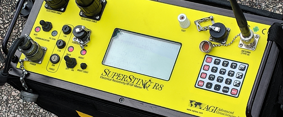


This system package includes: SuperSting™ R8 Wi-Fi with Tablet Controller and Marine Modules - Qty 1 Cable with 16 Graphite electrodes (Standard 3m or 6m electrode spacing. Custom spacing also available at no additional cost) - Qty 1 GPS/depth - Qty 1 SuperSting™ Manager (SSM) Android App - Qty 1 Survey Planner Module Precise Guided Navigation Module Marine Log Manager (MLM) Module Key to use EarthImager™ 2D Software - Qty 1 Continuous Resistivity Profiler (CRP) Module... Learn More

This system package includes: SuperSting™ R8 Wi-Fi with Tablet Controller - Qty 1 Cable with 14 electrodes (6.25m electrode spacing) - Qty 8 (making a total of 112 electrodes) SwitchBox Grid - Qty 1 Key to use EarthImager™ Software (Your choice of 2D or 3D) - Qty 1 Free admission for one person: 3-day training seminar (airfare & lodging not included) - Qty 1 Use Cases: We’ve designed this 112-electrode system package to handle various jobs. Below are just a few use cases that... Learn More

This system package includes: SuperSting™ R8 Wi-Fi with Tablet Controller - Qty 1 Cable of 14 electrodes (3.25m electrode spacing) - Qty 6 (making a total of 84 electrodes) SwitchBox Grid - Qty 1 Key to use EarthImager™ Software (Your choice of 2D or 3D) - Qty 1 Free admission for one person: 3-day training seminar (airfare & lodging not included) - Qty 1 Use Cases: We’ve designed this 84-electrode system package to handle various jobs. Below are just a few use cases that this... Learn More

This system package includes: SuperSting™ R8 Wi-Fi with Tablet Controller - Qty 1 Cable of 14 electrodes (6.25m electrode spacing OR 10.25m electrode spacing) - Qty 4 (making a total of 56 electrodes) SwitchBox Grid - Qty 1 Key to use EarthImager™ Software (Your choice of 2D or 3D) - Qty 1 Free admission for one person: 3-day training seminar (airfare & lodging not included) - Qty 1 Use Cases: We’ve designed this 56-electrode system package to handle various jobs. Below are... Learn More

This system package includes: SuperSting™ R8 Wi-Fi with Tablet Controller - Qty 1 Cable of 14 electrodes (6.25m electrode spacing) - Qty 2 (making a total of 28 electrodes) SwitchBox Grid - Qty 1 Key to use EarthImager™ Software (Your choice of 2D or 3D) - Qty 1 Free admission for one person: 3-day training seminar (airfare & lodging not included) - Qty 1 Use Cases: We’ve designed this 28-electrode system package to handle various jobs. Below are just a few use cases that... Learn More
When you can see what you're working with below the surface, you can make better decisions that save you time and money.
