- Office Hours: M-F 8:30 AM - 5:00 PM

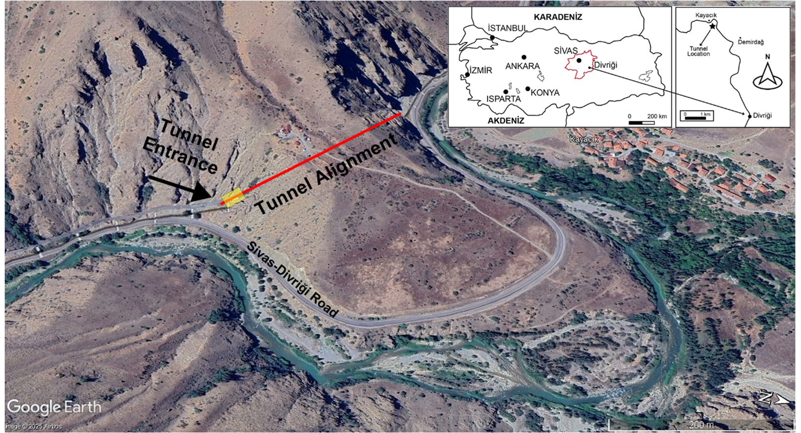
Water coming into tunnels cut through fractured rock is a long-term maintenance problem. Türkiye has more than 800 railway tunnels, and 660 of them are over 51 years old. In a tunnel in the Divriği district, about 150 km from Sivas, seepage and wet areas were visible along the sidewalls and in places at the crown. The host rock is fractured and jointed, and snowmelt and rain seep through it towards the tunnel.
The study aimed to map potentially water-bearing zones around the tunnel in 3D. The line could be closed for only four hours, and electrodes on the crown were impractical. The question was whether electrodes on the two sidewalls alone could provide useful 3D information.
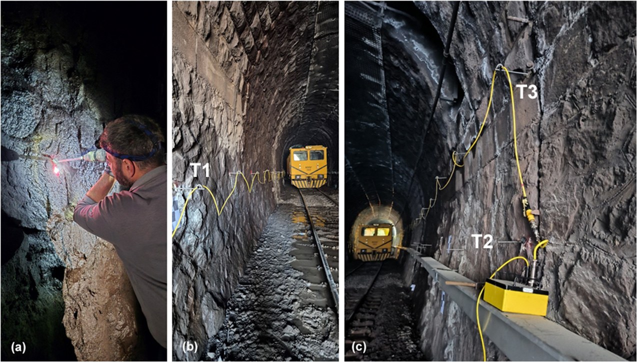
The data were collected with an AGI SuperSting™ R8/IP along three 54 m profiles. Each profile had 28 electrodes at 2 m spacing, placed in holes drilled into the sidewalls. One profile ran along the left wall and two along the right wall, at 1.5 m and 3.5 m above the floor. Pole–Dipole and Inverse Schlumberger arrays were used. The Inverse Schlumberger array suits multichannel acquisition, which added measurements within the short closure. Median contact resistance per profile was 6–17 kΩ. Both data sets, 1,092 measurements in total, were inverted together in 3D with R3t, using an unstructured mesh that included the tunnel cavity.
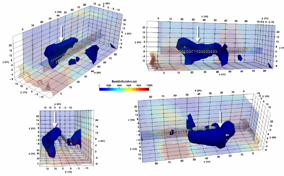
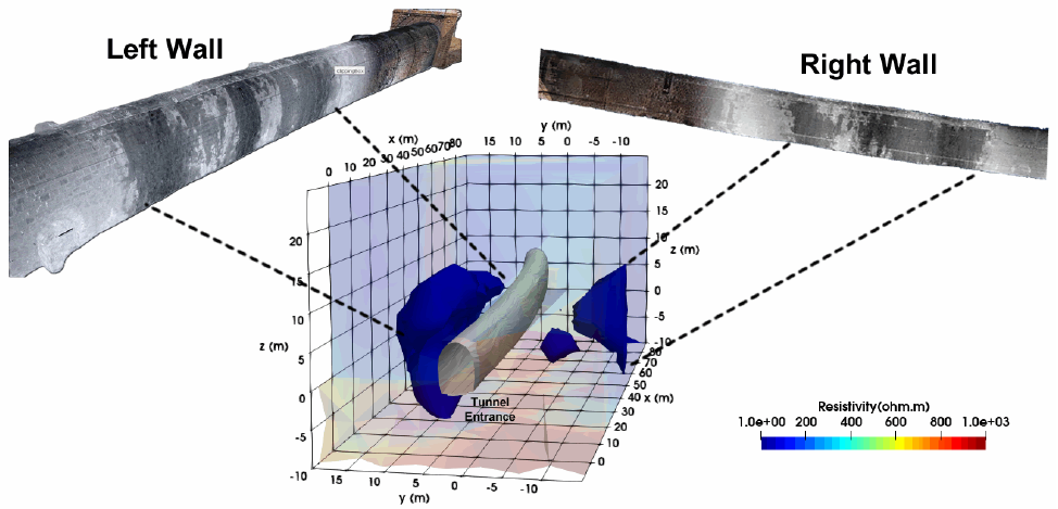
The 3D model shows low-resistivity zones next to both sidewalls, and some extend towards and above the crown. The paper reports them as potentially water-bearing zones that need targeted verification. Sensitivity was highest near the sidewall electrodes, so features there are better constrained than those at crown level.
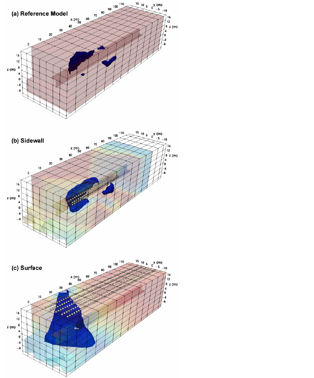
A synthetic test based on the field model showed that the sidewall layout recovers these structures. Five longer surface profiles of 56 electrodes each produced only a broad, poorly resolved anomaly.
Darker areas in LiDAR intensity scans of the lining, read as surface moisture, matched several of the anomalies.
Data and survey details courtesy of: N. Yıldırım Gündoğdu, Ankara University (Geophysical Modelling Group, Ankara University Technopolis).
Source: Gündoğdu, N. Y. (2026). Geosciences 16, 402. doi:10.3390/geosciences16100402. Figures reproduced under CC BY. Location imagery: Google Earth. LiDAR data: Pin Proje Mühendislik Ltd. Şti.