- Office Hours: M-F 8:30 AM - 5:00 PM
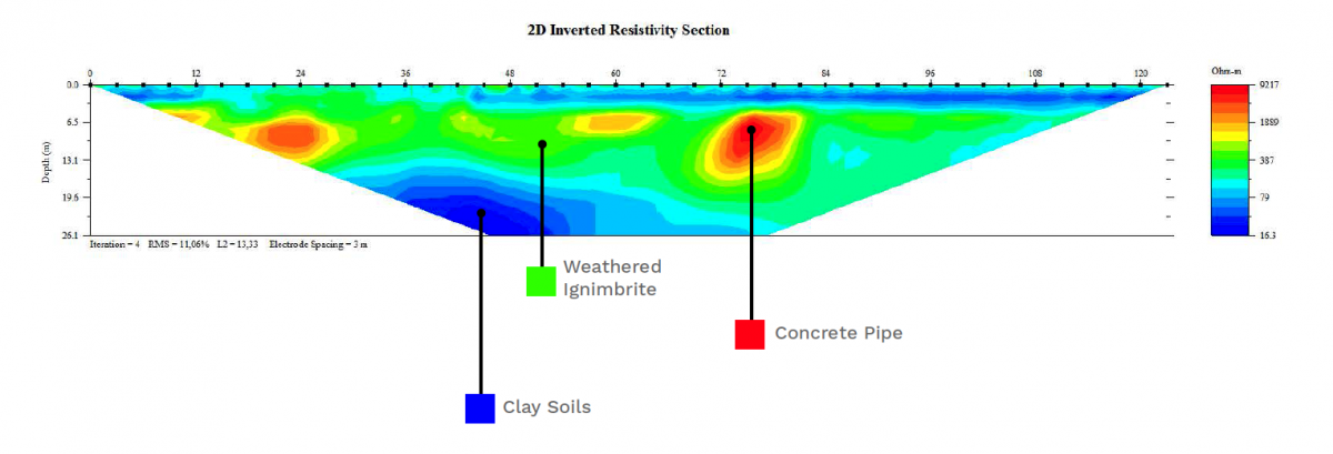
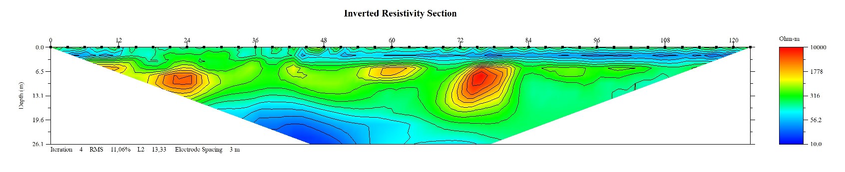
In February 2017, AGI hosted a seminar at the Costa Rican Institute of Aqueducts and Sewers (AyA). The main objective of the field test was to determine the geotechnical site characterization of the area where there are 8 wells that supplied water to the community. We also wanted to correlate the results obtained through the images of 2D resistivity imaging and the information of the wells.
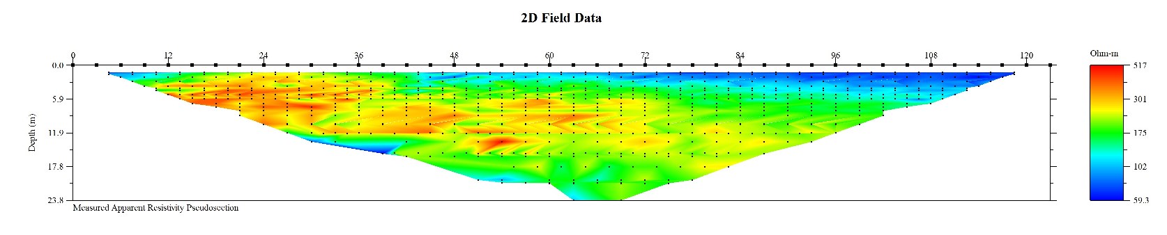
The resistivity survey was performed with the help of AGI, using a SuperSting™ Wi-Fi R8/IP/SP instrument. We also used AGI Passive Electrode Cables, 42 electrodes at 3 meter electrode spacing with a mixed array of Dipole-Dipole and Schlumberger. The data was processed with EarthImager™ 2D software.
The most outstanding result was the location of the old concrete aqueduct that supplies water to the Santa Ana community in San José, Costa Rica.