- Office Hours: M-F 8:30 AM - 5:00 PM
This geothermal energy project’s goal was to find optimal locations for natural hot springs. Not only was the location important, but the depth of the water as well.
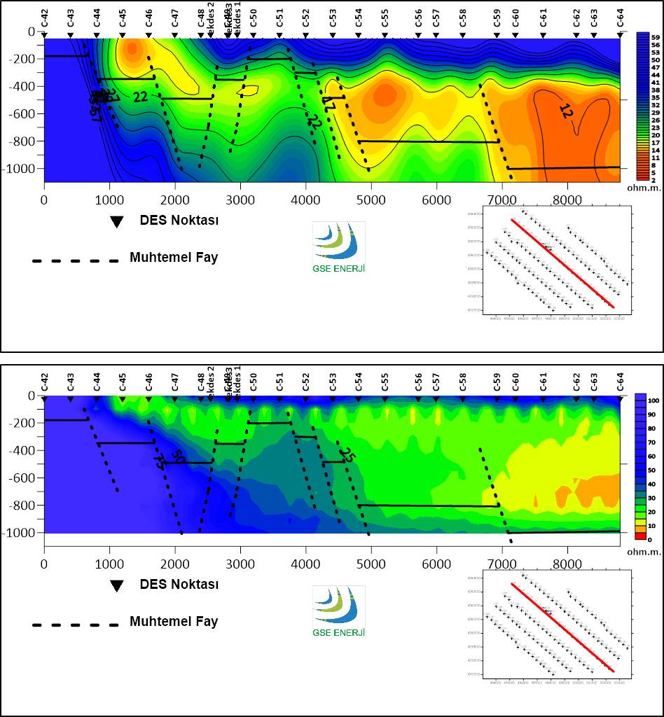
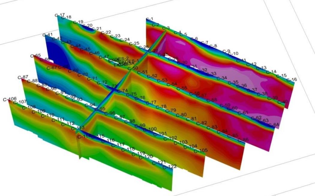
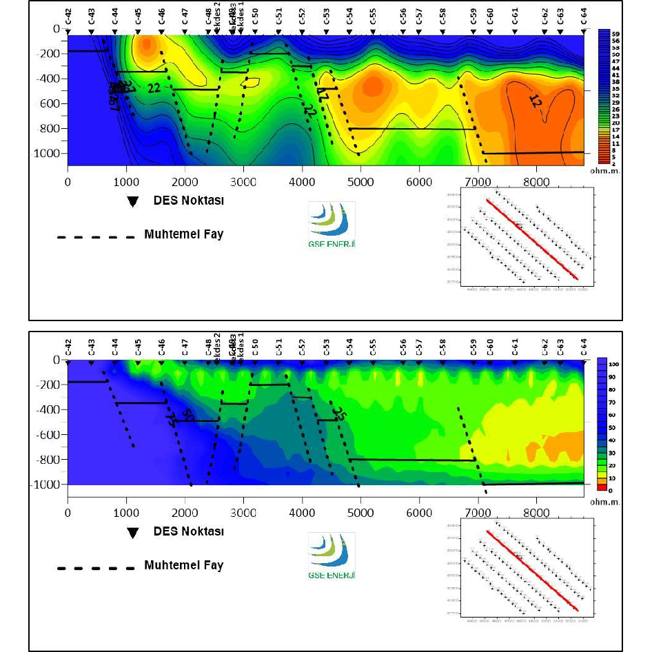
A total of 122 VES (Vertical Electrical Sounding) measurements, as well as Gravity, Radon, and CO2 measurements were performed on the 7x10km study area in Turkey. A SuperSting R1/IP/SP instrument was used for 122 Schlumberger VES measurements. The client used their own manual cables.
The VES data was evaluated with Radon, CO2, and Gravity data which identified three potential drilling zones. The drilling at one of these zones confirmed a 49ºC production temperature and 140l lt/sec flow rate of production. The VES data along a 2D line are mapped with AB/2 versus Apparent Resistivity. The 2D inversion is obtained from a combination of VES data along the 2D line. The possible faults are highlighted on the 2D sections. The 3D view of parallel 2D sections shows clearly the lateral variation of the low resistive zones not only along the line but also the cross line.