- Office Hours: M-F 8:30 AM - 5:00 PM
SuperSting™ R8 Wi-Fi with Tablet Controller - Qty 1
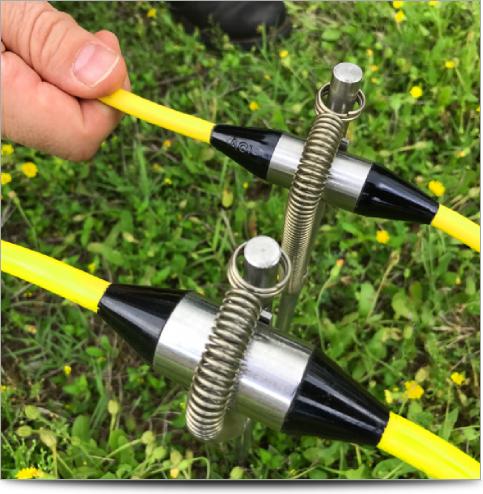
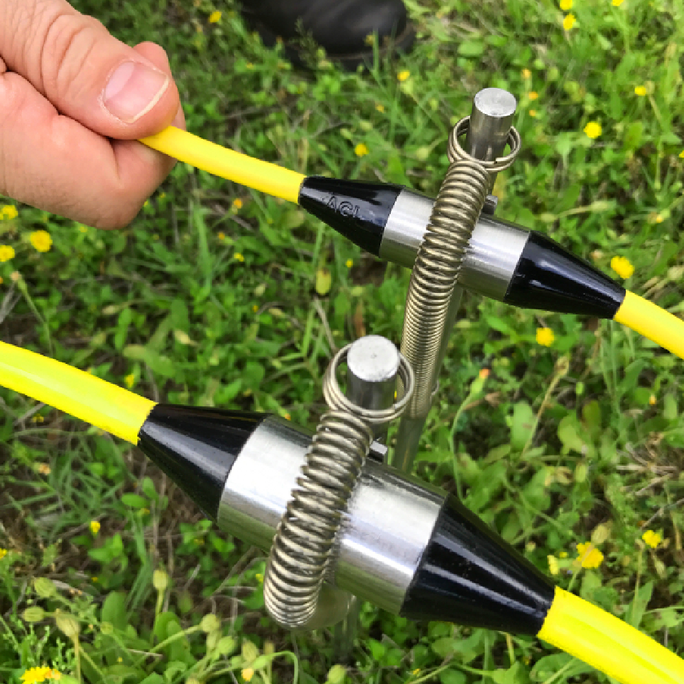
Cable of 14 electrodes (6.25m electrode spacing OR 10.25m electrode spacing) - Qty 4 (making a total of 56 electrodes)
SwitchBox Grid - Qty 1
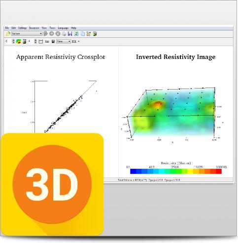
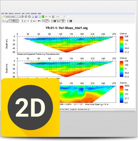
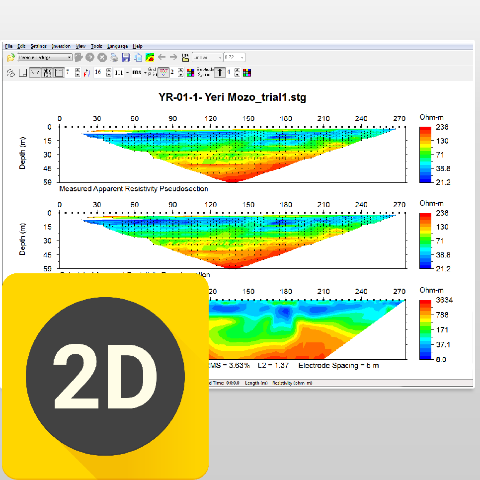
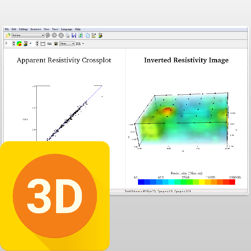
Key to use EarthImager™ Software (Your choice of 2D or 3D) - Qty 1
Free admission for one person: 3-day training seminar (airfare & lodging not included) - Qty 1
We’ve designed this 56-electrode system package to handle various jobs. Below are just a few use cases that this package would be ideal for:
Mineral Exploration
Metallic mineral investigations
Non-Metallic mineral and aggregate mining investigations
Geotechnical and Civil Engineering Investigations
Locating tunnels, caves, sinkholes, and fault- fractures
Dam and levee investigations
Groundwater Exploration
Irrigation
Drinking water
Saline/freshwater interface mapping along coastlines and petroleum drilled areas
Environmental and Monitoring Investigations
NAPL (DNAPL and LNAPL) pollution research for remediation of hydrocarbons
CO2 Sequestration Time-Lapse Monitoring
ASTM D7007: Geomembrane Leak Detection
Bedrock and Landfill Mapping
Grounding Surveys for Power Plants and Cell Phone Towers
Archeological Investigation
Borehole Logging
Short-Long-Leterolog-SP
Cross-borehole tomography
IEEE Standard 81: Fall of Potential (FOP) Method
ASTM G57: Wenner Soil Resistivity Test
Underwater and Marine Studies
Determining sub-bottom geology for dredging purposes
Monitoring leakage in a dam
Mapping fresh and saltwater interfaces near shorelines or offshore
Characterizing the sub-bottom of estuaries
Measuring water column salinity variations
Mineral exploration (usually placer deposits)
Locating freshwater springs at sea (submarine groundwater discharge)
Distinguishing between hard rock, sand, gravel, silt, and clay
Gas Hydrate Exploration
Subsurface geotechnical site investigation for oil platforms
Sediment research
Fracture Imaging
Resistivity and IP studies for deep mining, oil/gas investigations
You can rent this system from our partner, SAGA.
This system is qualified for 100% financing. Learn more.

When you can see what you're working with below the surface, you can make better decisions that save you time and money.