- Office Hours: M-F 8:30 AM - 5:00 PM
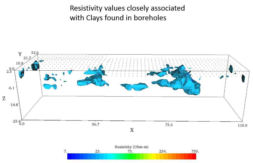
A multi-story parking garage structure was built for a hospital in east Texas, U.S.A. over an existing parking lot. This type of new construction involves advanced knowledge of the subsurface conditions for safety, excavation planning and both structure and drainage design. Three-dimensional (3D) Electrical Resistivity Imaging (ERI) was used to map clay and sandy-clay deposits previously identified in limited locations by shallow boreholes. 3D resistivity imaging models provided unprecedented new information for the structure design and project planning.
To 3D map the soil types and water content below ground in flat or rugged terrain with direct application to civil and geotechnical engineering, groundwater exploration, environmental remediation, archeological reconnaissance, and mineral exploration projects.
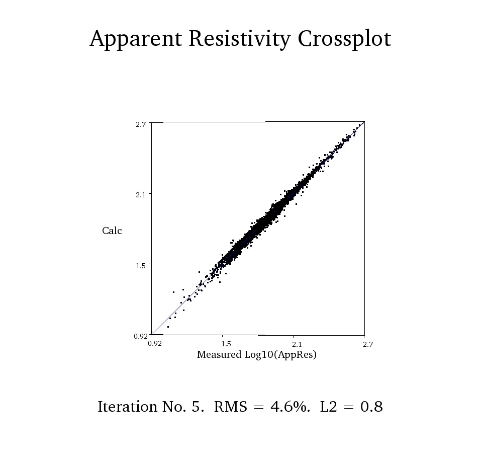
The 3D ERI survey was completed on March 30th of 2017. The 3D ERI survey consists of nine parallel two-dimensional profiles using a combination of both Dipole-Dipole and Strong-Gradient™ arrays. All arrays were collected with the SuperSting™ R8 WiFi, Switchbox 56, and the FlexLite Passive Electrode Cables with 56 electrodes. The in-line electrode spacing was 2m and the cross line electrode spacing was 4m. Nine parallel transects formed a 3D model with 504 total electrodes. This model was run with the AGI EarthImager™ 3D resistivity/IP inversion modeling software. The site surface conditions consisted of nearly 6 inches of asphalt pavement over clay and sandy clays previously identified by limited shallow borings.
3D electrical resistivity imaging successfully mapped expansive clays and faster draining sandy-clays as well as the shallow water table. Available shallow borings were correlated with the 3D ERI survey results. The 3D inverted resistivity model showed that there was no presence of shallow local bedrock that could raise the cost of the excavation and potentially change the design of the parking garage structure.
Specially designed tools: These rugged geophysical instruments are useful for electrical resistivity imaging in all kinds of terrain and topographic conditions including urban and remote setting, borehole settings, and marine or underwater settings.
High-resolution 3D ERI imaging: obtained by combining parallel 2D profiles to maximize the depth of investigation and survey speed.