- Office Hours: M-F 8:30 AM - 5:00 PM
In this project in Dubai, there were some concerning geological hazards beneath the proposed construction site of a 1000mm Dia Gravity Sewer Line. A geotechnical investigation was made in order to evaluate the extent and spatial variability of such hazards. These hazards included shallow loose soils, soft-rock materials, air-filled and/or water-filled holes.
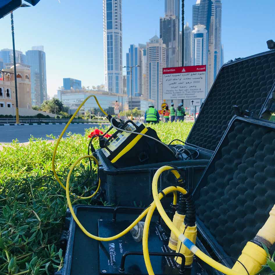
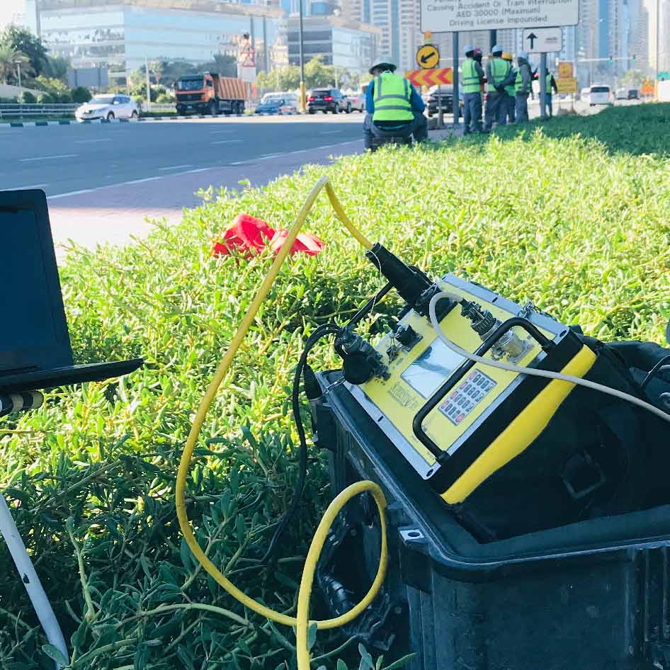
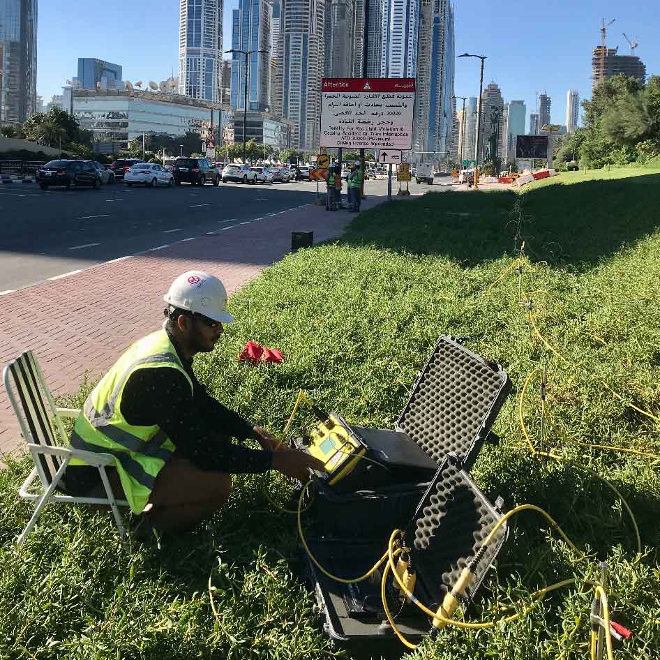
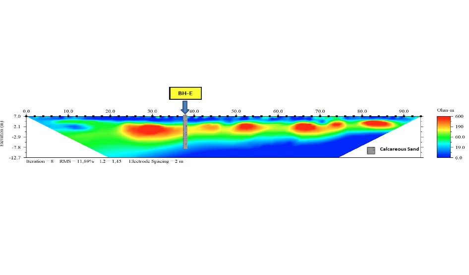
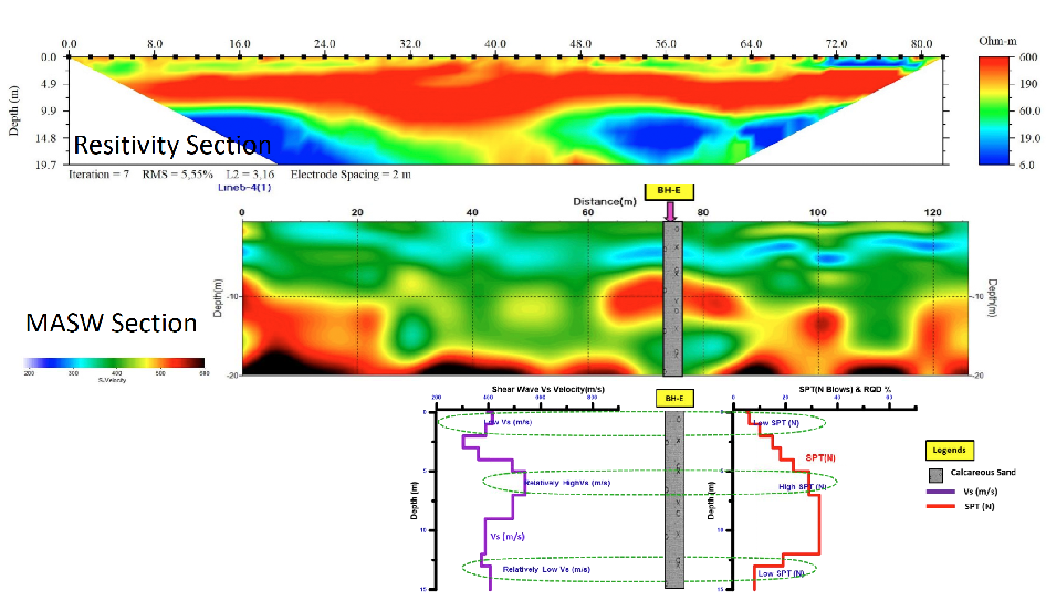
Electrical Resistivity Imaging (ERI, also known as ERT) data was acquired in conjuction with Multichannel Analysis Surface Wave (MASW) in order to investigate geohazards beneath the proposed construction site. For both methods of investigation, the client was looking for data corresponding to low shearwave velocity, low resistivity values, and low SPT(N)/RQD percentage results. The instruments used were a SuperSting™ R8/IP System, AGI 56 Electrode Passive Cables ith 2m spacing, and an AGI Switchbox 56. A Pole-Dipole array was used in order to collect Electrical Resistivity data.
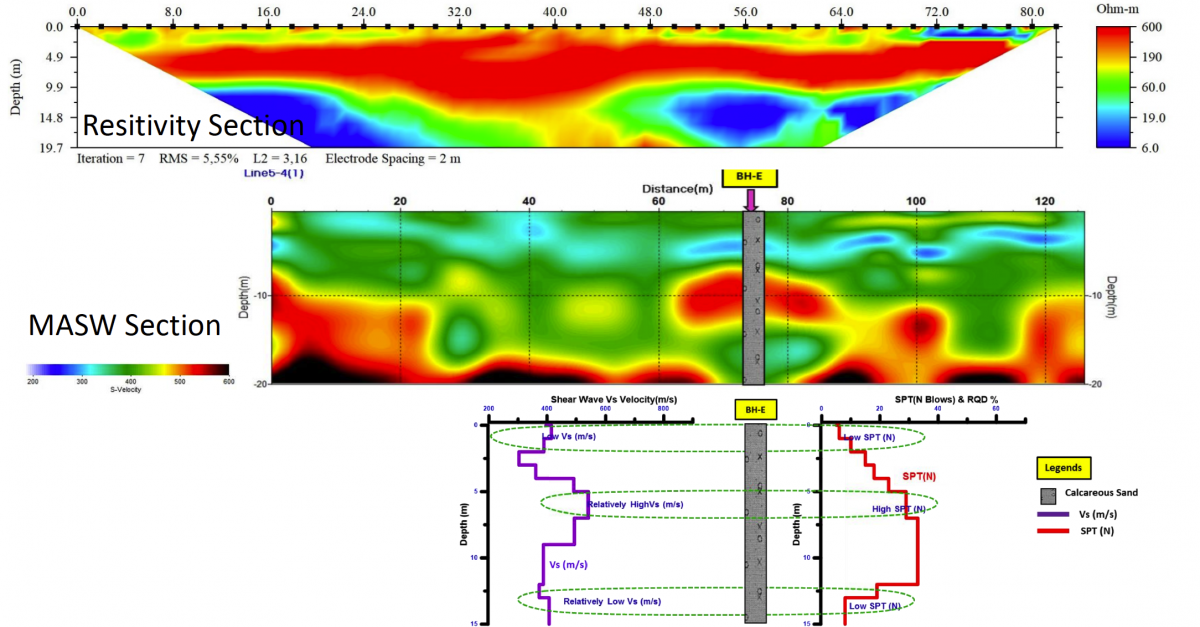
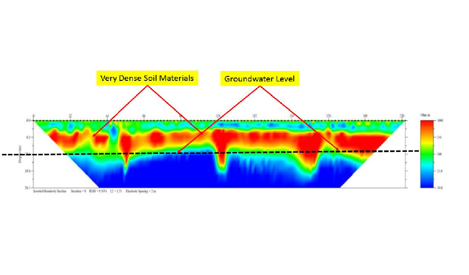
When the client did a comparison of the geophysical results with rock cores and borings, it allowed for the calibration of the geophysical data and improved interpretation. The extremely low resistivity values observed along all ERI lines confirmed the presence of highly-saturated and dense soil materials. The ERI profile also assisted in the approximating the spatial variability amongst all of the geohazards crossing the area of the proposed construction of Alignment and Installation of 1000mm Dia Gravity Sewer Line.
Data & Survey Details Courtesy of Tatweer (TGSC) ![]()