- Office Hours: M-F 8:30 AM - 5:00 PM

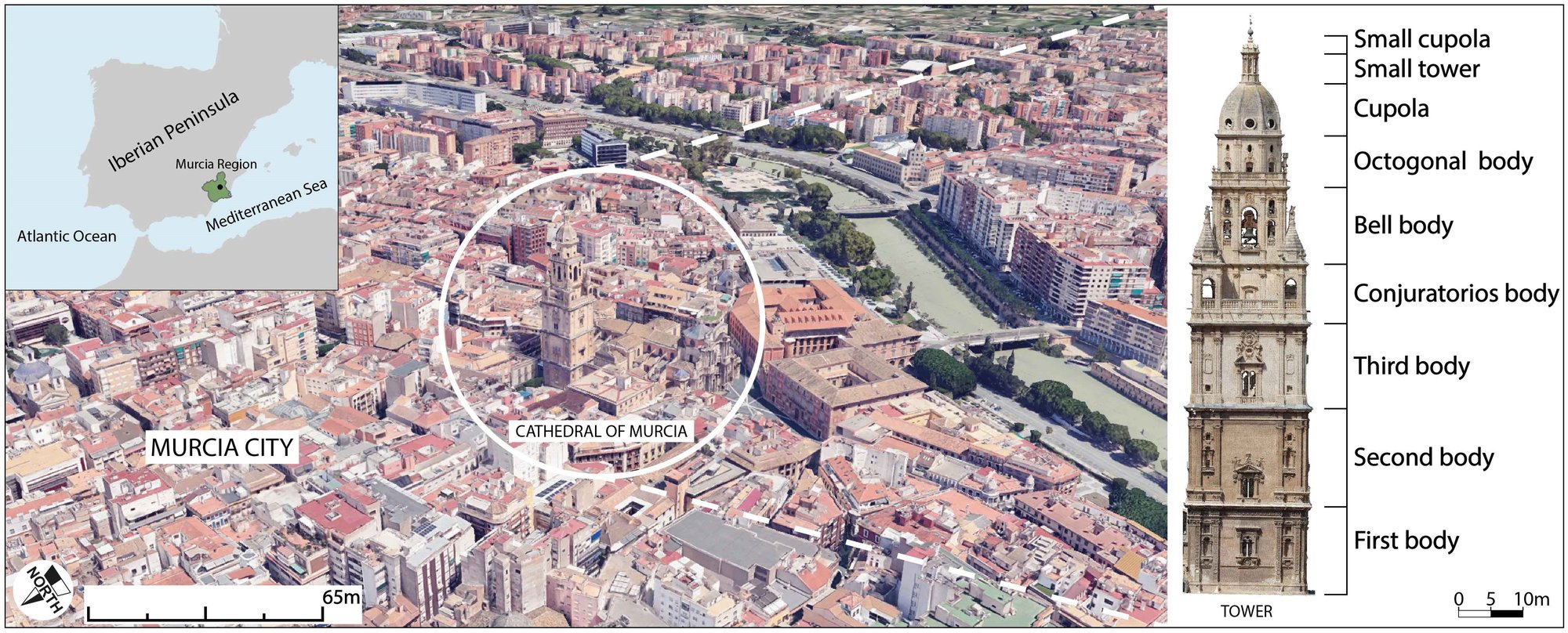
The Tower of Murcia Cathedral, in the urban centre of Murcia, southeast Spain, belongs to the “Santa Iglesia Catedral de Santa María” complex, a site of almost 5,000 m² with the highest degree of protection. The square masonry Tower was built between 1519 and 1793; work stopped for 201 years to correct differential settlement and the collapse of the east façade. Works against rising damp in 1999 and 2009 uncovered empty chambers and archaeological remains.
Surveying the foundations was difficult. Interior space is small, so 2D linear profiles long enough for useful depth would have to pass through the protected walls, and 2D profiles cannot resolve the ground beneath a wall.
The geophysical aim was to determine the singularities in the Tower's foundation slab with 3D electrical resistivity tomography (ERT), including the subsoil beneath its load-bearing walls. The ERT results were then checked against ground-penetrating radar (GPR) on the accessible inner surface and against archaeological studies.
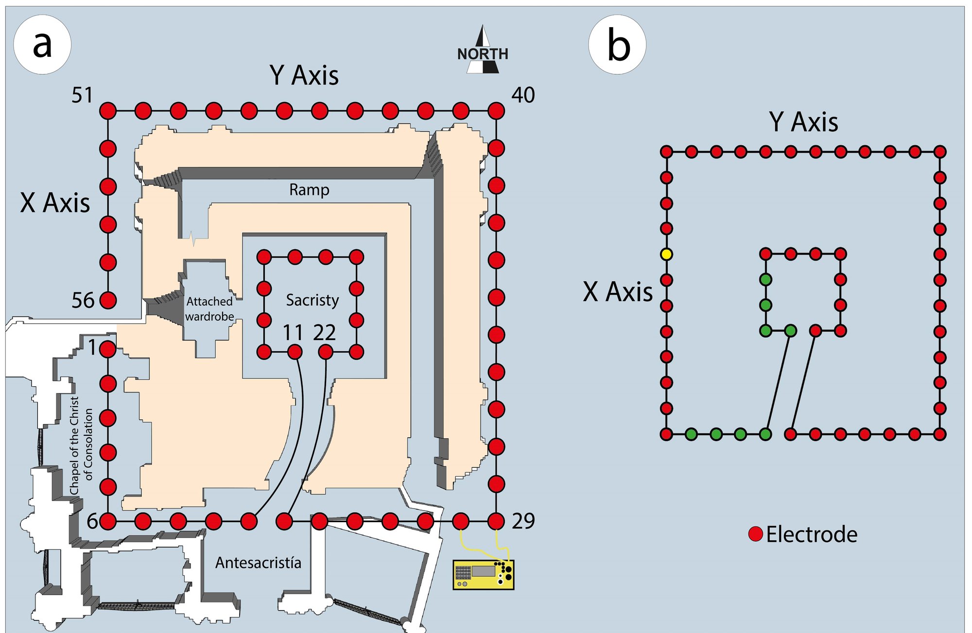
A second, methodological aim was to validate a procedure for protected towers with limited space: one continuous, nonlinear ERT profile along the outer and inner perimeters that yields a 3D model.
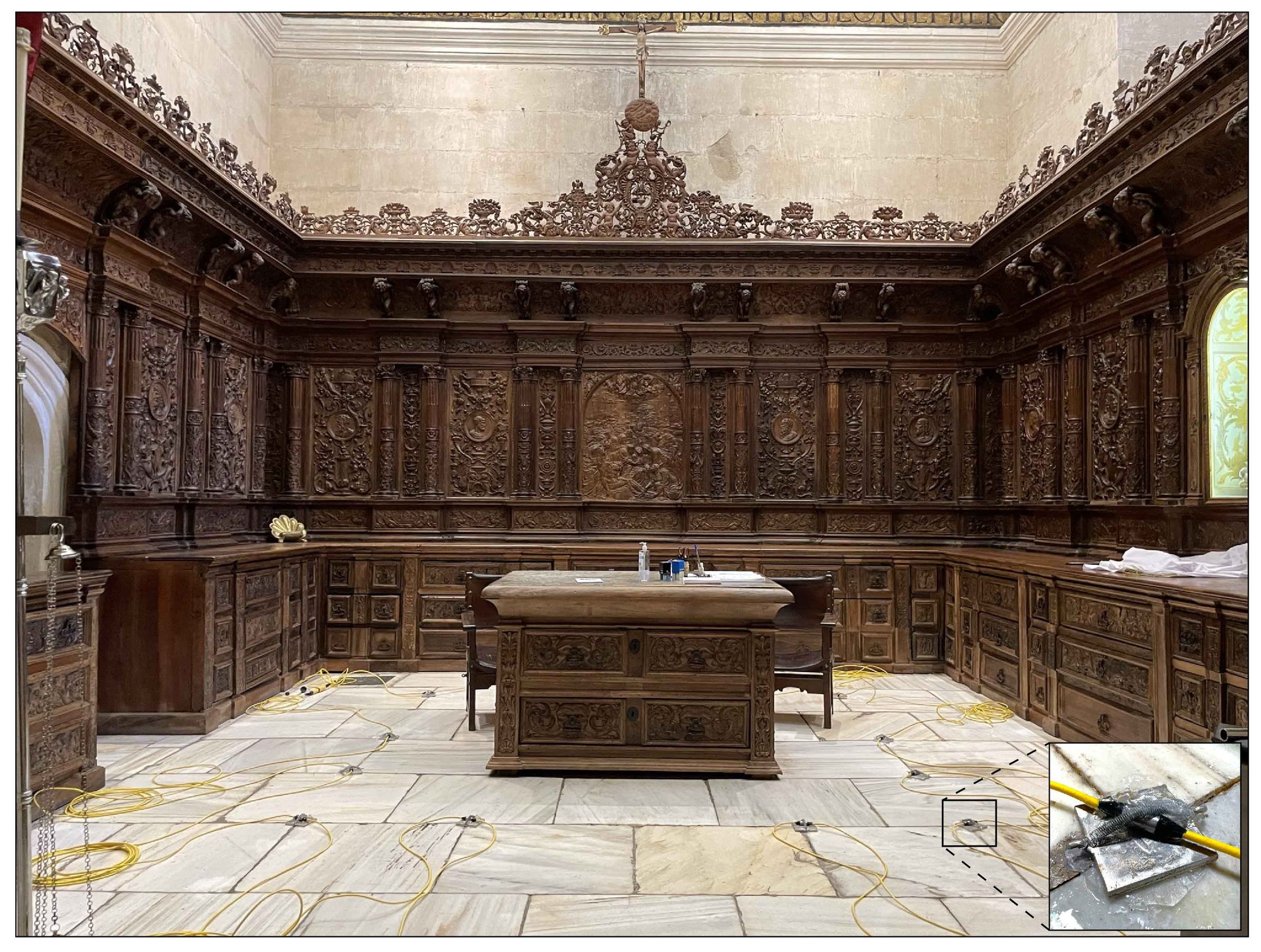
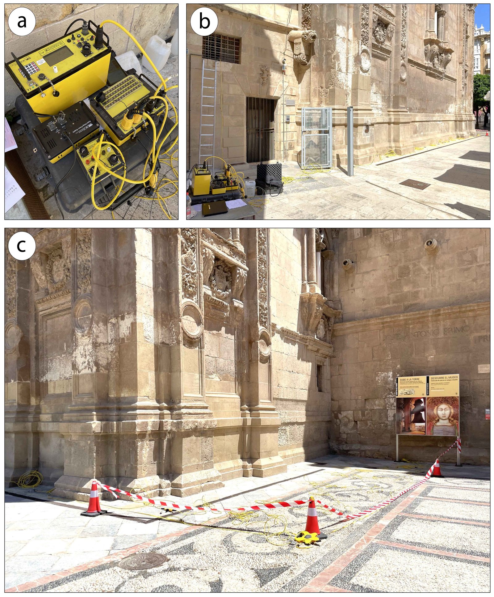
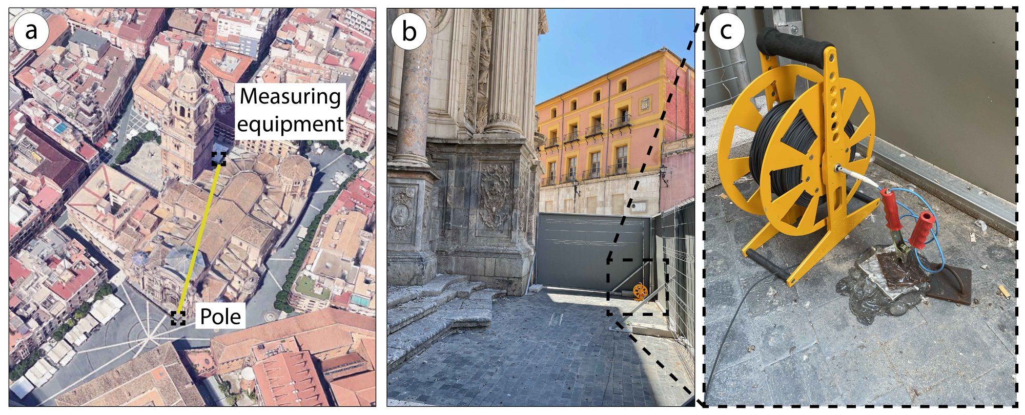
Data were collected with the SuperSting™ Wi-Fi R8 Resistivity/IP/SP DC multi-electrode resistivity system from AGI, with a Multi-Electrode SwitchBox (56 electrodes) and eight FlexLite Passive Electrode Cables of 7 electrodes each. To protect the historic floors, each electrode was held by a steel spring on a 100 × 100 × 10 mm aluminium plate, with a non-staining carbomer-based conductive gel between electrode and plate and between plate and floor.
The continuous profile formed a 22 × 22 m square (484 m²) outside the Tower at 2 m spacing and a 3 × 3 m square (9 m²) inside the sacristy at 1 m spacing. A pole–dipole array was used for greater depth, with the remote pole 80 m away outside the Cathedral's west façade. With 1.2 s current injection, 578 apparent resistivity values from 1 to 9,800 Ω·m were recorded. After outlier filtering, the data were inverted by least squares in AGI EarthImager™ 3D (L2 norm, 3% noise), reaching a normalised L2 of 1.1.
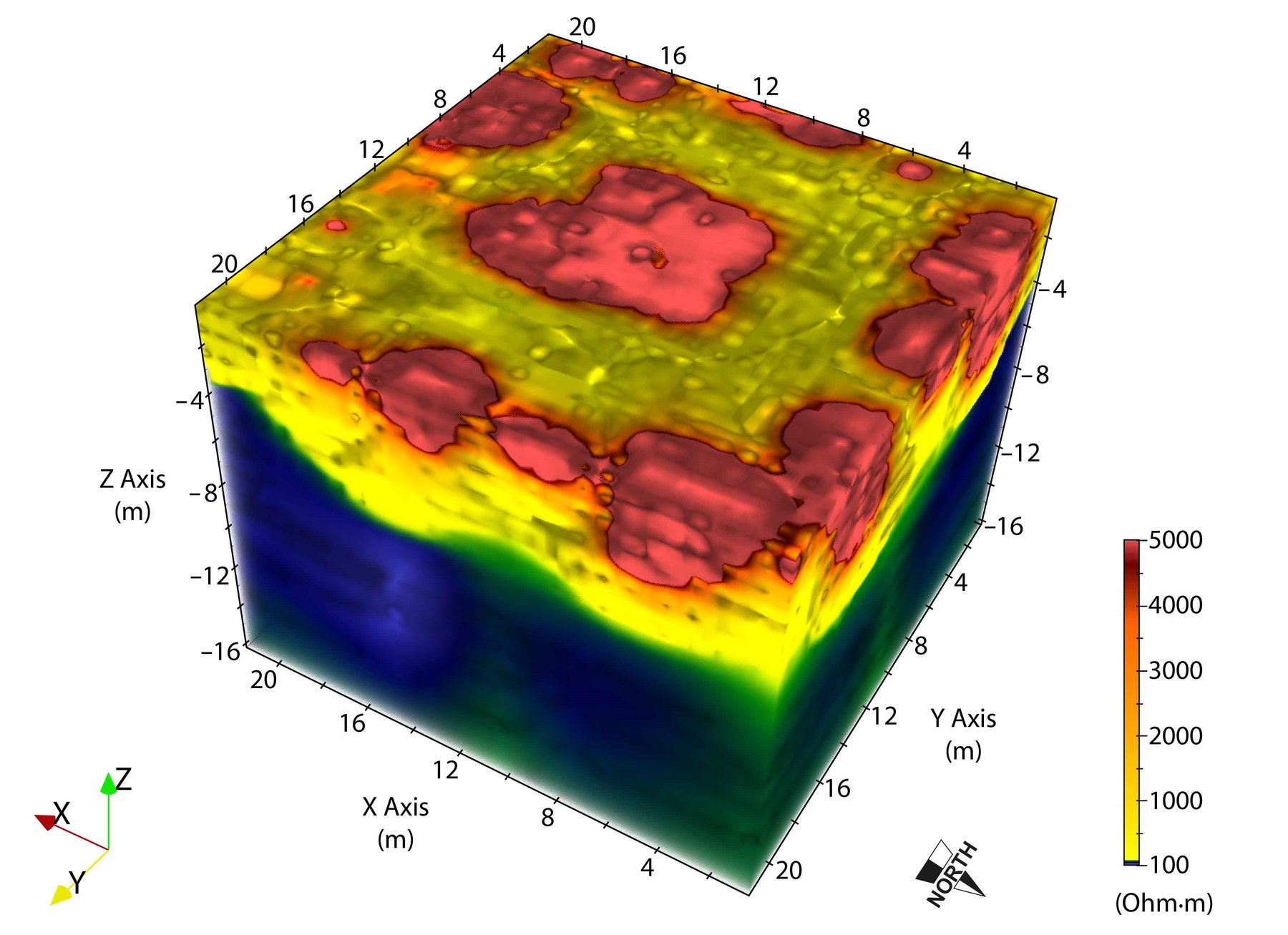
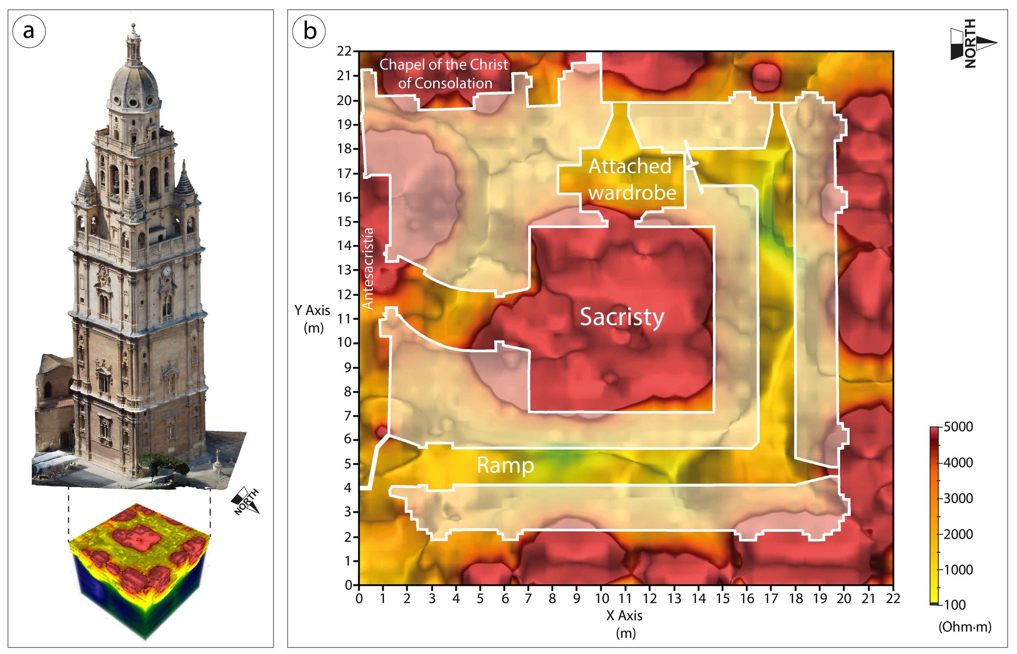
3D resistivity model: The model covers 22 × 22 m with a depth of investigation of 16.2 m and was displayed from 100 to 5,000 Ω·m to highlight the foundation slab. The slab has a variable depth and contains highly resistive zones of 4,000–5,000 Ω·m, interpreted as possible cavities.
Sacristy: High resistivity inside the Tower matches the four hollow chambers found in 2009, one in each corner of the sacristy; they were empty spaces, not burials. GPR inside the sacristy confirmed these cavities at around 1 m.
Around the Tower: In the Antesacristía, by the south face, a highly resistive zone could correspond to a documented well; in 1999 a new well was built there and the old one closed. By the west face, in the Chapel of the Christ of Consolation (completed 1818), another highly resistive zone has no historical data to confirm it and could be hollow chambers or even crypts. High resistivity along the east, north and west façades matches the aeration chambers built in 2009 against rising damp.
Method performance: The ERT anomalies agreed with the archaeological records and, in the sacristy, with the GPR comparison, verifying the continuous nonlinear layout. The authors conclude that it characterises foundation singularities quickly, versatilely and with respect for the heritage, reduces uncertainty, and supports conservation planning while saving time and costs.
Field tip: On protected floors, mount each electrode on a small aluminium plate with a steel spring, and put carbomer-based gel between electrode and plate and between plate and floor. The gel improves current flow and is removed without leaving a stain. After the survey, wash the stainless steel electrode takeouts on the FlexLite passive cables with tap water to remove any remaining gel and salt and to avoid corrosion.
Data and survey details courtesy of: María C. García-Nieto, Marcos A. Martínez-Segura and Pedro Martínez-Pagán, Department of Mining and Civil Engineering, Universidad Politécnica de Cartagena; Manuel Navarro, Department of Applied Physics, University of Almería; and Ignacio Valverde-Palacios, Department of Building Construction, University of Granada. The authors thank the Cabildo of the Santa Iglesia Catedral de Murcia for its support.
AGI products used:
Source: García-Nieto, M. C.; Martínez-Segura, M. A.; Navarro, M.; Valverde-Palacios, I.; Martínez-Pagán, P. (2024). A Geophysical Investigation in Which 3D Electrical Resistivity Tomography and Ground-Penetrating Radar Are Used to Determine Singularities in the Foundations of the Protected Historic Tower of Murcia Cathedral (Spain). Remote Sensing 16, 4117. doi:10.3390/rs16214117. © 2024 by the authors, licensee MDPI, Basel, Switzerland. Open access under the Creative Commons Attribution (CC BY 4.0) license. Figures reproduced under CC BY 4.0.